For King Manuel, “Brazil was but a farm on the Atlantic road with no other value”; the new possession had to acquire importance a few years after its discovery when a real colonizing process began and only since then was the first administrative organization of the colony given. In fact, after the expedition entrusted to Martin Alfonso de Souza, appointed logar lieutenant de el rey in 1530, it was thought to implement in Brazil the division into 12 captains which is generally reported to the period 1532-1535. The vast region was divided into bands or parallel zones that stretched inland from the coast to where the royal domain extended. Evidently the western limit of these areas could not be well determined, as well as poorly defined and only theoretical were the northern and southern limits of each area, given the insufficient knowledge about the actual extent of the Brazilian coast. Thus the order to assign 50 leagues of coast between Pernambuco and the Río de La Plata to each captain was not followed to the letter, because in practice the particular physical conditions advised to move the limits of the zones differently: these were actually fifteen, they extended southwards only to about 28 ° 20 ‘S. latitude, that is, without reaching the coast of Rio Grande do Sul. The effective coastal extent of each of these zones ranged from 30 to 50 Portuguese leagues, 17 and a half per grade; the Capitania del Maranhão then, including 3 zones, had a coastal development of 225 leagues.
The division of the colony into 12 hereditary, inalienable captains, given as a fief to Portuguese fidalgos could only be implemented after 1540; so is the paper that in the first volume of the Review of Brasil fixes the limits of the 12 captains, it refers to the condition of things that actually occurs in 1549. The general government of Brazil was established above these divisions, which was to maintain the union between the various captains. The general government which was based in the new city of S. Salvador da Bahia was subsequently ruled by Thomé de Souza (1548-1552), Duarte da Costa (1553-1557) and Mem de Sá (1558-1572). On the death of this governor, the great extension of the colony, the diversity of living conditions among its various parts and the difficulties against which the administration had to fight, advised the division into two general governments. The royal charter of 10 December 1572 established Bahia as the capital of the first government, which included the northern capitals from that of Pernambuco to that of Porto Seguro; while the capital of the other general government, which included the southern captains, was Rio de Janeiro. In 1577 there was a return to a single government which had Bahia as its capital, but in 1608 the division into two governments was again proceeded, which were again unified five years later, while in 1621 the northern territory was detached from Brazil (corresponding approximately to the current states of Ceará, Piauhy, Maranhão, Pará, and part of the state of Amazonas) which with the name of “Estado independente de Maranhão” was directly subject to the metropolitan government. In 1640 the government of Bahia was constituted in viceroyalty and in 1642 the “Ultramarine Council” was created which proceeded to the division of the country into 10 captains, whose limits remained on the whole the same until the century. XVIII. For Brazil political system, please check diseaseslearning.com.
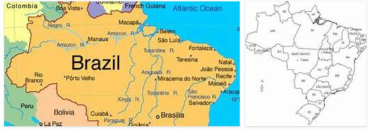
The current political division, which in its general lines reflects the administrative one of the imperial period, is directly connected with the republican constitution of 1891 when the country took the name of Estados Unidos do Brazil, and with the treaty of 1903, with which the last question of borders was resolved. Since 1926, Washington Luiz Pereira de Souza has been its president, succeeded by Julio Presters de Albuquerque. The confederation comprises a federal district, 20 states and a territory. Among the states that are officially classified into four series: (maritime, frontier, maritime frontier, interior), the largest is the interior of Amazonas whose area corresponds to 21.5% of the total area of the confederation, the least it is the maritime area of Alagôas whose area corresponds to 0.34% of the total area, while the territory of Acre corresponds to 1.74%, and the federal district to 0.01%.
As for the population of the individual states, from a maximum of about 6 million residents numbered in 1920 in the state of Minas Geraes, it drops to a quarter of a million in the state of Matto Grosso. The average area of the Brazilian state is a little higher than 400,000 sq km. (418,099); the average population a little less than 1.5 million residents. (1,469,267).
Each state is divided into a certain number of “municipios” of highly variable area, and the municipality into various number of “districtos”. In 1920, at the time of the census, the first were 1304 in total; the second 3877. Apart from the federal district consisting of a single municipality (Rio de Janeiro) – the minimum number of municipalities was found in Matto Grosso (21), Amazonas (28), Santa Catharina and Sergipe (34); the most in S. Paolo (204), Minas (178), Bahia (136), Rio Grande do Sul (711). Similarly, the number of districtos was lower in Matto Grosso and Sergipe (36), Rio Grande do Norte (37) and Piauhy (39); major in Minas Geraes (789), Bahia (406), S. Paolo (398), Rio Grande do Sul (311).
Both the municipalities and the districts are more numerous in the states with older colonization and greater population: the increase in the number of residents and the cultivation of new territories led to the establishment of new administrative units: in fact we know that in 1927 the municipalities were 1421.